
فائل:Mediterranean Sea political map-blank.svg

Size of this PNG preview of this SVG file: ۸۰۰ × ۵۸۵ پکسلز. دوجے ریزولوشنز: ۳۲۰ × ۲۳۴ پکسلز | ۶۴۰ × ۴۶۸ پکسلز | ۱,۰۲۴ × ۷۴۹ پکسلز | ۱,۲۸۰ × ۹۳۶ پکسلز | ۲,۵۶۰ × ۱,۸۷۲ پکسلز | ۲,۰۴۶ × ۱,۴۹۶ پکسلز ۔
اصل فائل (ایس وی جی فائل، پکسل:۲,۰۴۶ × ۱,۴۹۶، فائل سائز: ۱.۰۶ میگابائٹ)
خلاصہ
| تفصیل |
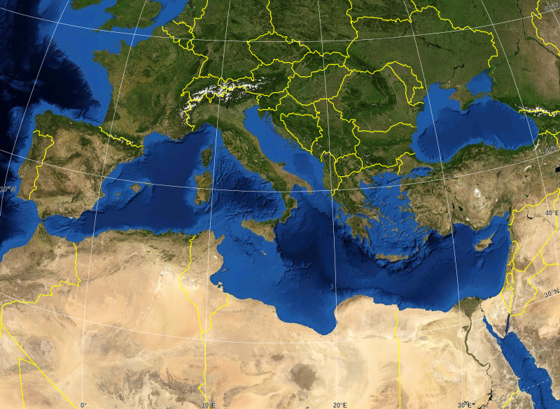
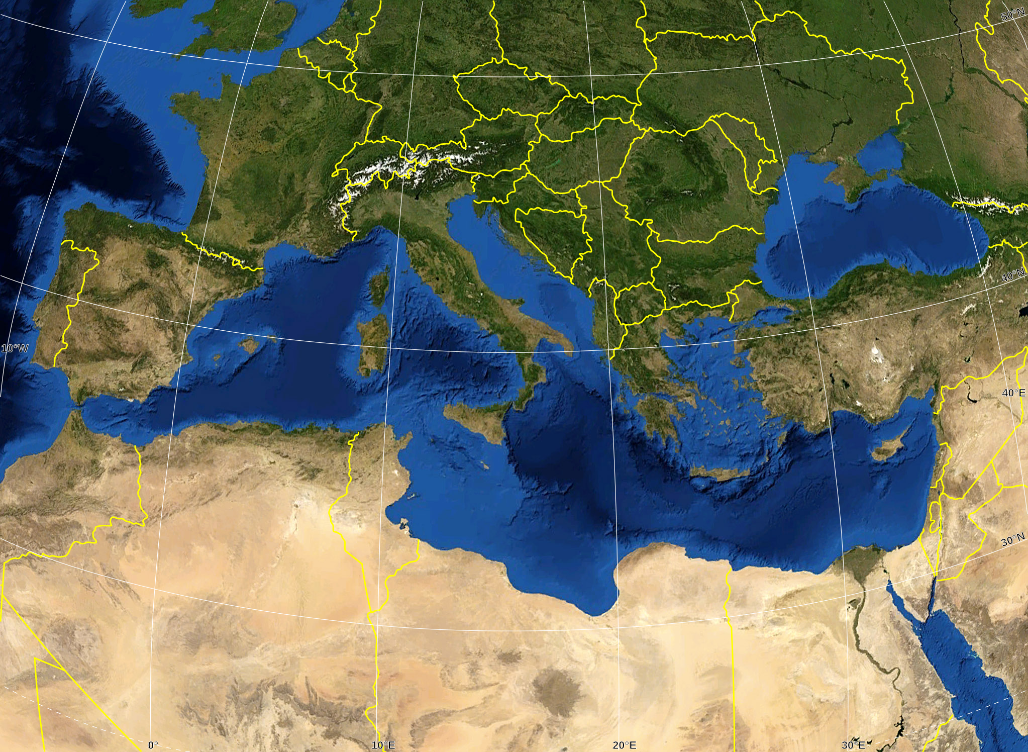
English: Blank map of the Mediterranean Sea, with the State borders.
Français : Carte vierge de la Mer Méditerranée avec les frontières nationales. |
| تریخ | |
| سروت |
Own work ; Raster background map : screenshot from NASA World Wind (Public Domain) |
| لکھاری | Eric Gaba (Sting - fr:Sting) |
| اجازت (فائل نوں دوبارہ ورتنا) |
All rights released |
| دوجے ورژن |
Derivative works of this file: Delian League Campaign Map.png
|


لائسنس –
| This image is in the public domain because it is a screenshot from NASA’s globe software World Wind using a public domain layer, such as Blue Marble, MODIS, Landsat, SRTM, USGS or GLOBE.
|
 |
| This work was previously under Public Domain, or a Free License. It has been digitally enhanced and/or modified. This derivative work has been (or is hereby) released into the public domain by its author, Sting at the French Wikipedia project. This applies worldwide. In some countries this is not legally possible; if so:
|
فائل دی تریخ
فائل نو اس ویلے دی حالت وچ ویکھن واسطے تاریخ/ویلے تے کلک کرو۔
| تریخ تے ویلہ | نکی مورت | پاسے | ورتن والا | تیپّݨی کرو | |
|---|---|---|---|---|---|
| موجودہ | ۲۱:۱۴, ۱۹ مئی ۲۰۰۸ | | ۲,۰۴۶ × ۱,۴۹۶ (۱.۰۶ میگابائٹ) | Sting | "Tropic of Cancer" label correction |
| ۰۶:۰۷, ۲۱ جون ۲۰۰۷ |  | ۲,۰۴۶ × ۱,۴۹۶ (۱.۰۶ میگابائٹ) | Sting | {{Information |Description=Blank map of the Mediterranean Sea, with the State borders. |Source=Own work ;<br/>Background map : screenshot from NASA World Wind (Public Domain) |Date=June 2007 |Author=Eric Gaba ([[User:Sting|Sting] |
فائل دی ورتوں
اس فائل نال جڑیا کوئی صفحہ نئیں۔
فائل ویاپک ورتوں
ایہہ دوجے وکیاں ایس فائل نوں ورتدے نیں –
- ar.wikipedia.org تے ورتوں
- fr.wikipedia.org تے ورتوں
- gv.wikipedia.org تے ورتوں
- id.wikipedia.org تے ورتوں
- pl.wiktionary.org تے ورتوں