
فائل:SouthAtlanticStates.png
اصل فائل (۹۰۴ × ۵۹۳ پکسلز, فائل حجم: ۱۷ کلوبائٹ, MIME type: image/png)
Hi
خلاصہ
| تفصیل |
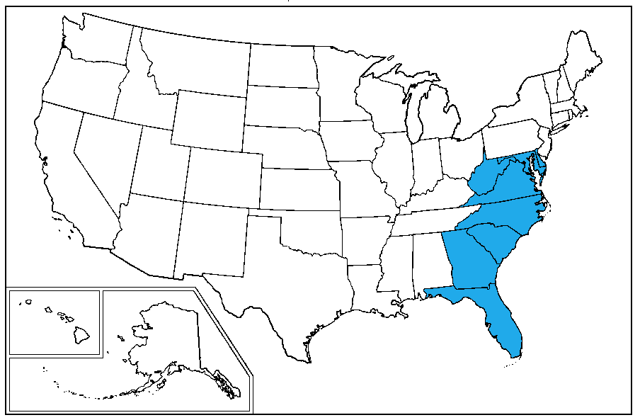
English: A map of the United States Census Bureau Region 3, Division 5, "South Atlantic", consisting of the states of Delaware, Maryland, Virginia, West Virginia, North Carolina, South Carolina, Georgia and the District of Columbia |
|||||
| تریخ | ||||||
| سروت | Own creation | |||||
| لکھاری | Dubyavee | |||||
| اجازت (فائل نوں دوبارہ ورتنا) |
|
|||||
- Florida is missing from the description**
لائسنس –
| کاپی حق چھڈیا: آرٹ دا ایہ کم کھلا اے؛ تسیں اینوں ونڈ سکدے او یا بدل سکدے او Free Art License دیاں شرطاں نال۔ تسیں ایدے لسنس دی اک ادھارن Copyleft Attitude site تے Copyleft Attitude site تے ہور سائیٹاں تے لب سکدے او |
فائل دی تریخ
فائل نو اس ویلے دی حالت وچ ویکھن واسطے تاریخ/ویلے تے کلک کرو۔
| تریخ تے ویلہ | نکی مورت | پاسے | ورتن والا | تیپّݨی کرو | |
|---|---|---|---|---|---|
| موجودہ | ۰۵:۵۳, ۹ مارچ ۲۰۱۰ | | ۹۰۴ × ۵۹۳ (۱۷ کلوبائٹ) | Dubyavee | {{Information |Description={{en|1=A map of the United States Census Bureau Region 3, Division 5, "South Atlantic", consisting of the states of Delaware, Maryland, Virginia, West Virginia, North Carolina, South Carolina, Georgia and the District of Columbi |
فائل دی ورتوں
تھلے دتے گئے 1 صفحے اس فائل نال جُڑدے نیں
فائل ویاپک ورتوں
ایہہ دوجے وکیاں ایس فائل نوں ورتدے نیں –
- ar.wikipedia.org تے ورتوں
- de.wikipedia.org تے ورتوں
- en.wikipedia.org تے ورتوں
- it.wikipedia.org تے ورتوں
- la.wikipedia.org تے ورتوں
- pt.wikipedia.org تے ورتوں
- sc.wikipedia.org تے ورتوں
- ur.wikipedia.org تے ورتوں
- www.wikidata.org تے ورتوں