
فائل:South Sudan adm location map.svg

اصل فائل (ایس وی جی فائل، پکسل:۱,۵۶۱ × ۱,۱۳۳، فائل سائز: ۲۰۱ کلوبائٹ)
خلاصہ
| تفصیل |
Deutsch: Positionskarte von Südsudan
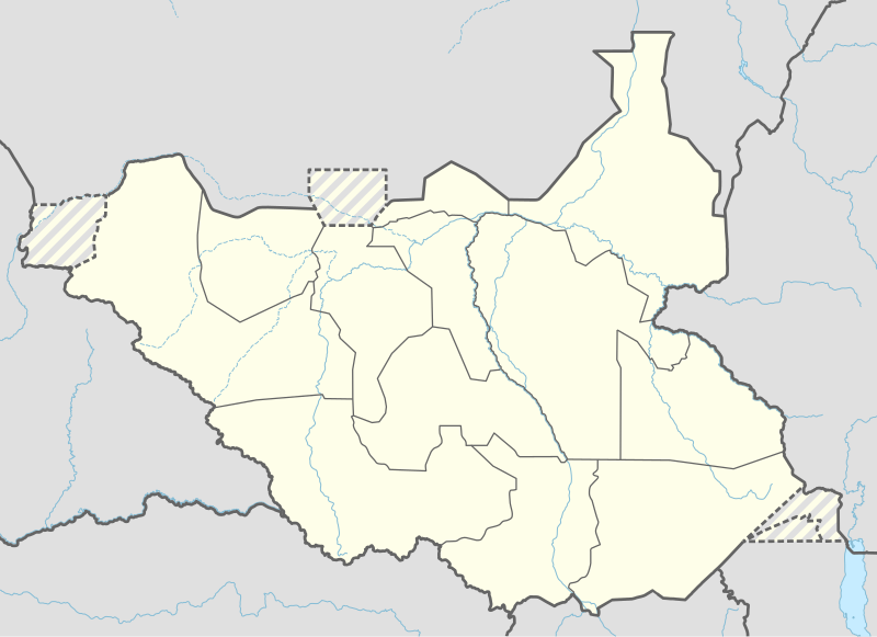
English: Location map of South Sudan
|
||||||||||||
| تریخ | |||||||||||||
| سروت |
Own work using:
|
||||||||||||
| لکھاری | NordNordWest | ||||||||||||
| دوجے ورژن |
|
||||||||||||
_adm_location_map.svg)
_adm_location_map.svg)


|
This map has been made or improved in the German Kartenwerkstatt (Map Lab). You can propose maps to improve as well.
|
لائسنس –
Usage of this file with:

explanatory notes: Legally binding is only the full legalcode. For a free usage I recommend to respect the following licence conditions:
1. Provide my name as given above: NordNordWest,
2. a copy of, or the URI for, the applicable license: https://creativecommons.org/licenses/by-sa/3.0/de/legalcode,
3. the title of the work,
4. in the case of an adaptation, a credit identifying the use of the work in the adaptation.
This license and the rights granted hereunder will terminate automatically upon any breach by you of the terms of this license. Any of the above conditions can be waived if you get permission from the copyright holder. If you have questions or wish differing conditions, please contact me through nnwest or my discussion page ![]() t-online.de
t-online.de
- تہانوں کھلھ اے:
- حصہ کرنا – کاپی، ونڈنا تے کم بھیجنا
- فیر رلانا – کم نوں فٹ کرنا
- تھلے دتیاں شرطاں نال:
- کس دے ناں – تسیں لازمی ایس کم دے بناں والے بارے دسو جنج اونے آکھیا اے یا جنج لسنس چ آکھیا گیا ہے۔
- اکو جہا شئیر کرو۔ – اگر تسیں بدلدے یا ایس کم تے بناندے تے بنن والے کم نوں اینج دے لسنس نال ای ونڈو گے۔

فائل دی تریخ
فائل نو اس ویلے دی حالت وچ ویکھن واسطے تاریخ/ویلے تے کلک کرو۔
| تریخ تے ویلہ | نکی مورت | پاسے | ورتن والا | تیپّݨی کرو | |
|---|---|---|---|---|---|
| موجودہ | ۲۳:۲۵, ۲۳ اپریل ۲۰۲۰ | | ۱,۵۶۱ × ۱,۱۳۳ (۲۰۱ کلوبائٹ) | Leviavery | Added Pibor and Ruweng Administrative Areas |
| ۲۱:۱۶, ۲۵ فروری ۲۰۲۰ |  | ۱,۵۶۱ × ۱,۱۳۳ (۱۹۹ کلوبائٹ) | Myrabert01 | Reverted to version as of 13:47, 25 February 2020 (UTC) South Sudan revert back to 10 States. https://www.aljazeera.com/news/2020/02/6-years-war-peace-finally-south-sudan-200223114919537.html | |
| ۱۹:۳۹, ۲۵ فروری ۲۰۲۰ |  | ۱,۵۶۱ × ۱,۱۳۳ (۲۱۳ کلوبائٹ) | NordNordWest | Reverted to version as of 14:39, 13 August 2016 (UTC); no reason for this revert | |
| ۱۸:۴۷, ۲۵ فروری ۲۰۲۰ |  | ۱,۵۶۱ × ۱,۱۳۳ (۱۹۹ کلوبائٹ) | Myrabert01 | Reverted to version as of 18:18, 12 November 2014 (UTC). South Sudan revert back to 10 States. | |
| ۱۹:۳۹, ۱۳ اگست ۲۰۱۶ |  | ۱,۵۶۱ × ۱,۱۳۳ (۲۱۳ کلوبائٹ) | NordNordWest | corr | |
| ۱۷:۳۱, ۱۲ اگست ۲۰۱۶ |  | ۱,۵۶۱ × ۱,۱۳۳ (۲۱۴ کلوبائٹ) | NordNordWest | upd, new states | |
| ۲۳:۱۸, ۱۲ نومبر ۲۰۱۴ |  | ۱,۵۶۱ × ۱,۱۳۳ (۱۹۹ کلوبائٹ) | NordNordWest | == {{int:filedesc}} == {{Information |Description= {{de|1=Positionskarte von Südsudan}} {{en|1=Location map of South Sudan}} {{Location map series N |stretching=101 |top=12.7 |bottom=3.2 |left=23.15 |right=36.4 }} |Source={{Own using}} * United States... |
فائل دی ورتوں
تھلے دتے گئے 1 صفحے اس فائل نال جُڑدے نیں
فائل ویاپک ورتوں
ایہہ دوجے وکیاں ایس فائل نوں ورتدے نیں –
- ab.wikipedia.org تے ورتوں
- af.wikipedia.org تے ورتوں
- an.wikipedia.org تے ورتوں
- av.wikipedia.org تے ورتوں
- azb.wikipedia.org تے ورتوں
- az.wikipedia.org تے ورتوں
- be.wikipedia.org تے ورتوں
- bg.wikipedia.org تے ورتوں
- bn.wikipedia.org تے ورتوں
- bs.wikipedia.org تے ورتوں
- ceb.wikipedia.org تے ورتوں
ایس فائل دا ویکھو ہور جگت ورتن .