
فائل:Spain Galicia location map.svg

Size of this PNG preview of this SVG file: ۵۱۲ × ۵۵۳ پکسلز. دوجے ریزولوشنز: ۲۲۲ × ۲۴۰ پکسلز | ۴۴۴ × ۴۸۰ پکسلز | ۷۱۱ × ۷۶۸ پکسلز | ۹۴۸ × ۱,۰۲۴ پکسلز | ۱,۸۹۶ × ۲,۰۴۸ پکسلز ۔
اصل فائل (ایس وی جی فائل، پکسل:۵۱۲ × ۵۵۳، فائل سائز: ۵۷۶ کلوبائٹ)
خلاصہ
| تفصیل |
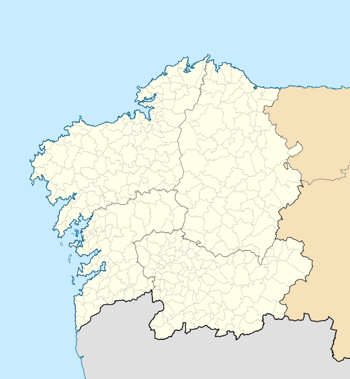
English: Location map of Galicia (Spain)
Equirectangular projection, N/S stretching 130 %. Geographic limits of the map:
Español: Mapa de localización de la comunidad autónoma de Galicia (España)
Proyección equirrectangular, N/S estirada 130 %. Límites geográficos del mapa:
|
|
| تریخ | ||
| سروت | Own work based on: EspañaLoc.svg by HansenBCN | |
| لکھاری | Miguillen | |
| SVG genesis | This locator map was created with Inkscape.
|
لائسنس –
Miguillen، اس کم دے کاپیرائٹ دا مالک، اس کم نوں اس لائسنس دے مطابق چھاپدا واں:
ایس فائل نوں کریٹو کامنز Attribution 2.5 پولینڈ لائسنس دتا گیا.
کس دے ناں: Miguillen
- تہانوں کھلھ اے:
- حصہ کرنا – کاپی، ونڈنا تے کم بھیجنا
- فیر رلانا – کم نوں فٹ کرنا
- تھلے دتیاں شرطاں نال:
- کس دے ناں – تسیں لازمی ایس کم دے بناں والے بارے دسو جنج اونے آکھیا اے یا جنج لسنس چ آکھیا گیا ہے۔
- اکو جہا شئیر کرو۔ – اگر تسیں بدلدے یا ایس کم تے بناندے تے بنن والے کم نوں اینج دے لسنس نال ای ونڈو گے۔
فائل دی تریخ
فائل نو اس ویلے دی حالت وچ ویکھن واسطے تاریخ/ویلے تے کلک کرو۔
| تریخ تے ویلہ | نکی مورت | پاسے | ورتن والا | تیپّݨی کرو | |
|---|---|---|---|---|---|
| موجودہ | ۰۲:۴۹, ۲۰ اکتوبر ۲۰۱۶ | | ۵۱۲ × ۵۵۳ (۵۷۶ کلوبائٹ) | HombreDHojalata | [http://www.xunta.es/dog/Publicados/2013/20130607/AnuncioG0244-060613-0003_gl.html DECRETO 83/2013, do 6 de xuño, polo que se aproba a fusión voluntaria dos municipios de Oza dos Ríos e Cesuras e se constitúe o municipio de Oza-Cesuras] DOG, 7 de x... |
| ۰۲:۳۳, ۲۰ اکتوبر ۲۰۱۶ |  | ۵۱۲ × ۵۵۳ (۵۷۶ کلوبائٹ) | HombreDHojalata | [http://www.xunta.gal/dog/Publicados/2016/20161017/AnuncioG0244-131016-0001_gl.html DECRETO 134/2016, do 22 de setembro, polo que se aproba a fusión voluntaria dos municipios de Cerdedo e Cotobade e se constitúe o municipio de Cerdedo-Cotobade], DOG... | |
| ۲۳:۳۲, ۲۰ مئی ۲۰۱۰ |  | ۵۱۲ × ۵۵۳ (۵۵۱ کلوبائٹ) | Miguillen | color mar | |
| ۲۰:۲۸, ۲۰ مئی ۲۰۱۰ |  | ۵۱۲ × ۵۵۳ (۵۵۱ کلوبائٹ) | Miguillen | == {{int:filedesc}} == {{Information |Description={{en|Location map of Galicia (Spain)}} Equirectangular projection, N/S stretching 130 %. Geographic limits of the map: * N: 43.055249° N * S: 39.750129° N * W: 2.282836° O * E: 0. |
فائل دی ورتوں
تھلے دتے گئے 1 صفحے اس فائل نال جُڑدے نیں
فائل ویاپک ورتوں
ایہہ دوجے وکیاں ایس فائل نوں ورتدے نیں –
- ar.wikipedia.org تے ورتوں
- ast.wikipedia.org تے ورتوں
- az.wikipedia.org تے ورتوں
- ba.wikipedia.org تے ورتوں
- be.wikipedia.org تے ورتوں
- bg.wikipedia.org تے ورتوں
- ca.wikipedia.org تے ورتوں
- ceb.wikipedia.org تے ورتوں
- cs.wikipedia.org تے ورتوں
- de.wikipedia.org تے ورتوں
ایس فائل دا ویکھو ہور جگت ورتن .