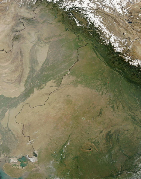
فائل:Thar Desert satellite.jpg

ایس وکھالے دا ناپ: ۴۷۱ × ۵۹۹ پکسلز۔ دوجے ریزولوشنز: ۱۸۹ × ۲۴۰ پکسلز | ۵۰۰ × ۶۳۶ پکسلز ۔
اصل فائل (۵۰۰ × ۶۳۶ پکسلز, فائل حجم: ۳۲۹ کلوبائٹ, MIME type: image/jpeg)
فائل دی تریخ
فائل نو اس ویلے دی حالت وچ ویکھن واسطے تاریخ/ویلے تے کلک کرو۔
| تریخ تے ویلہ | نکی مورت | پاسے | ورتن والا | تیپّݨی کرو | |
|---|---|---|---|---|---|
| موجودہ | ۱۹:۲۵, ۱۷ ستمبر ۲۰۰۵ |  | ۵۰۰ × ۶۳۶ (۳۲۹ کلوبائٹ) | Crux | Satellite Image of Thar Desert, India/Pakistan (border line in the middle) from en:, uploaded by en:User:Tom Radulovich |
فائل دی ورتوں
تھلے دتے گئے 1 صفحے اس فائل نال جُڑدے نیں
فائل ویاپک ورتوں
ایہہ دوجے وکیاں ایس فائل نوں ورتدے نیں –
- ar.wikipedia.org تے ورتوں
- az.wikipedia.org تے ورتوں
- bg.wikipedia.org تے ورتوں
- bn.wikipedia.org تے ورتوں
- bs.wikipedia.org تے ورتوں
- ckb.wikipedia.org تے ورتوں
- de.wikipedia.org تے ورتوں
- en.wikipedia.org تے ورتوں
- eo.wikipedia.org تے ورتوں
- es.wikipedia.org تے ورتوں
- et.wikipedia.org تے ورتوں
- fa.wikipedia.org تے ورتوں
- fi.wikipedia.org تے ورتوں
- fr.wikipedia.org تے ورتوں
- he.wikipedia.org تے ورتوں
- hu.wikipedia.org تے ورتوں
- it.wikipedia.org تے ورتوں
- ja.wikipedia.org تے ورتوں
- ka.wikipedia.org تے ورتوں
- kk.wikipedia.org تے ورتوں
- kn.wikipedia.org تے ورتوں
- ko.wikipedia.org تے ورتوں
- ky.wikipedia.org تے ورتوں
- lfn.wikipedia.org تے ورتوں
- lt.wikipedia.org تے ورتوں
- mai.wikipedia.org تے ورتوں
- mg.wikipedia.org تے ورتوں
- mk.wikipedia.org تے ورتوں
- ml.wikipedia.org تے ورتوں
- mr.wikipedia.org تے ورتوں
- ms.wikipedia.org تے ورتوں
- ne.wikipedia.org تے ورتوں
- nn.wikipedia.org تے ورتوں
- pa.wikipedia.org تے ورتوں
- pl.wikipedia.org تے ورتوں
- pt.wikipedia.org تے ورتوں
ایس فائل دا ویکھو ہور جگت ورتن .


