
فائل:USA Counties.svg

Size of this PNG preview of this SVG file: ۵۵۵ × ۳۵۲ پکسلز. دوجے ریزولوشنز: ۳۲۰ × ۲۰۳ پکسلز | ۶۴۰ × ۴۰۶ پکسلز | ۱,۰۲۴ × ۶۴۹ پکسلز | ۱,۲۸۰ × ۸۱۲ پکسلز | ۲,۵۶۰ × ۱,۶۲۴ پکسلز ۔
اصل فائل (ایس وی جی فائل، پکسل:۵۵۵ × ۳۵۲، فائل سائز: ۱.۱۱ میگابائٹ)

|
This file has been superseded by Usa counties large.svg. It is recommended to use the other file. Please note that deleting superseded images requires consent. Reason to use the other file: "Contains county names and county codes in the svg code"
|

|
| تفصیل |
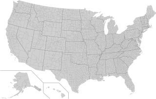
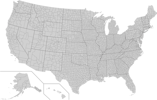
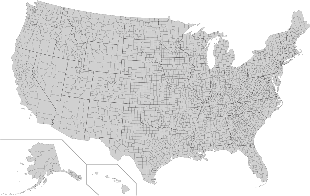
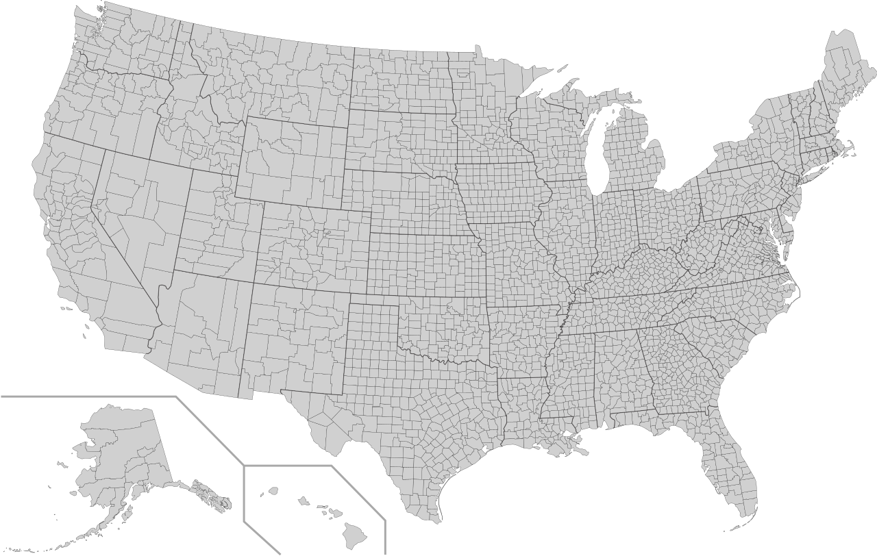
English: This is a map of the United States showing the borders of states and counties in high detail. |
|||
| سروت |
It was derived from this public-domain document published by the U.S. Census Bureau. |
|||
| لکھاری | U.S. Census Bureau | |||
| اجازت (فائل نوں دوبارہ ورتنا) |
|
|||
| دوجے ورژن | Derivative works of this file: Usa counties large.svg | |||
| SVG genesis |

فائل دی تریخ
فائل نو اس ویلے دی حالت وچ ویکھن واسطے تاریخ/ویلے تے کلک کرو۔
| تریخ تے ویلہ | نکی مورت | پاسے | ورتن والا | تیپّݨی کرو | |
|---|---|---|---|---|---|
| موجودہ | ۱۰:۱۸, ۱۰ اگست ۲۰۲۲ | | ۵۵۵ × ۳۵۲ (۱.۱۱ میگابائٹ) | DemonDays64 | Fixed some problems: merged southern part of Unorganized Alaska into one shape; properly labeled Somerset MD, which Accomack VA had been mislabeled as |
| ۱۱:۲۲, ۱۷ ستمبر ۲۰۲۰ |  | ۵۵۵ × ۳۵۲ (۱.۱۱ میگابائٹ) | DemonDays64 | Fixed misspelling of "Albemarle" as "Albermarle" | |
| ۲۰:۵۶, ۱۰ ستمبر ۲۰۱۸ |  | ۵۵۵ × ۳۵۲ (۱.۱۱ میگابائٹ) | JoKalliauer | restored id-names and css from 03:49, 26. Mär. 2016 | |
| ۱۱:۳۸, ۳۰ اگست ۲۰۱۸ |  | ۵۵۵ × ۳۵۲ (۶۷۰ کلوبائٹ) | JoKalliauer | Smaller file-size. Cleaner code. valid file | |
| ۰۸:۴۹, ۲۶ مارچ ۲۰۱۶ |  | ۵۵۵ × ۳۵۲ (۱.۵۸ میگابائٹ) | Spesh531 | updating borders, more accurate | |
| ۲۰:۴۷, ۲۳ دسمبر ۲۰۰۷ |  | ۵۵۵ × ۳۵۲ (۲.۰۳ میگابائٹ) | Lokal Profil | Fixed state borders and fixed the two parts of Fulton County (Kentucky) | |
| ۰۷:۲۰, ۱۰ دسمبر ۲۰۰۷ |  | ۵۵۵ × ۳۵۲ (۲.۰۴ میگابائٹ) | Lokal Profil | Graphical and code cleanup | |
| ۰۶:۱۵, ۱۰ دسمبر ۲۰۰۷ |  | ۷۹۲ × ۶۱۲ (۲.۰۴ میگابائٹ) | Lokal Profil | First stab at a code cleanup | |
| ۰۵:۱۴, ۲۹ اگست ۲۰۰۶ |  | ۷۹۲ × ۶۱۲ (۲.۷۱ میگابائٹ) | Petr Dlouhý | Original file: en:Image:USA CountiesSVG.zip This ZIP file contains an SVG map of the United States showing the borders of states and counties in high detail. It was derived from [http://www2.census.gov/geo/maps/special |
فائل دی ورتوں
تھلے دتے گئے 1 صفحے اس فائل نال جُڑدے نیں
فائل ویاپک ورتوں
ایہہ دوجے وکیاں ایس فائل نوں ورتدے نیں –
- af.wikipedia.org تے ورتوں
- en.wikipedia.org تے ورتوں
- fa.wikipedia.org تے ورتوں
- fi.wikipedia.org تے ورتوں
- he.wikipedia.org تے ورتوں
- hi.wikipedia.org تے ورتوں
- hu.wikipedia.org تے ورتوں
- io.wikipedia.org تے ورتوں
- pt.wikipedia.org تے ورتوں
- ro.wikipedia.org تے ورتوں
- sh.wikipedia.org تے ورتوں
- sq.wikipedia.org تے ورتوں
- sr.wikipedia.org تے ورتوں
- tr.wikipedia.org تے ورتوں
- ur.wikipedia.org تے ورتوں