
فائل:Austrian Empire (1815).svg

Size of this PNG preview of this SVG file: ۴۵۰ × ۴۵۶ پکسلز. دوجے ریزولوشنز: ۲۳۷ × ۲۴۰ پکسلز | ۴۷۴ × ۴۸۰ پکسلز | ۷۵۸ × ۷۶۸ پکسلز | ۱,۰۱۱ × ۱,۰۲۴ پکسلز | ۲,۰۲۱ × ۲,۰۴۸ پکسلز ۔
اصل فائل (ایس وی جی فائل، پکسل:۴۵۰ × ۴۵۶، فائل سائز: ۶۹۱ کلوبائٹ)
خلاصہ


.svg)
.svg)
.svg)
.svg)
.svg)


.svg)
.svg)
.svg)


.png)
.png)


.svg)


.svg)

.svg)


.svg)
.svg)
.svg)
.svg)


.svg)
.png)


.svg)


.svg)
.svg)


.svg)


.svg)


.svg)
.svg)
.svg)
.svg)
.svg)
.svg)
.svg)
.svg)
_cropped.svg)
.svg)
.svg)
.svg)
.svg)
.svg)
.svg)
.svg)
.svg)
.svg)
.svg)
.svg)
.svg)
.svg)
.svg)
.svg)
.svg)
.svg)
.svg)
.svg)
.svg)
.svg)
.svg)
.svg)
.svg)
.svg)
.svg)
.svg)
.svg)
.svg)
.svg)
.svg)
.svg)
.svg)
.svg)
.svg)
.svg)
.svg)
.svg)
.svg)
.svg)
.svg)
.svg)
.svg)
.svg)
.svg)
فائل دی تریخ
فائل نو اس ویلے دی حالت وچ ویکھن واسطے تاریخ/ویلے تے کلک کرو۔
| تریخ تے ویلہ | نکی مورت | پاسے | ورتن والا | تیپّݨی کرو | |
|---|---|---|---|---|---|
| موجودہ | ۱۴:۵۸, ۱۶ اپریل ۲۰۱۹ | | ۴۵۰ × ۴۵۶ (۶۹۱ کلوبائٹ) | TRAJAN 117 | +++ |
| ۰۲:۲۰, ۱۳ اگست ۲۰۱۳ |  | ۴۵۰ × ۴۵۶ (۶۵۴ کلوبائٹ) | TRAJAN 117 | Update | |
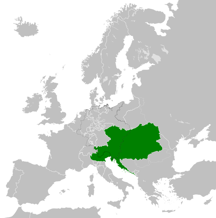
| ۱۰:۴۷, ۱۲ اگست ۲۰۱۳ |  | ۴۵۰ × ۴۵۶ (۱ میگابائٹ) | TRAJAN 117 | {{Information |Description ={{en|1=The Austrian Empire in 1815.}} |Source ={{own}} {{AttribSVG|Blank map of Europe 1815.svg|Alphathon}} |Author =TRAJAN 117 {{created with Inkscape}} |Date =2013-08-12 |Pe... |
فائل دی ورتوں
اس فائل نال جڑیا کوئی صفحہ نئیں۔
فائل ویاپک ورتوں
ایہہ دوجے وکیاں ایس فائل نوں ورتدے نیں –
- af.wikipedia.org تے ورتوں
- ast.wikipedia.org تے ورتوں
- azb.wikipedia.org تے ورتوں
- ba.wikipedia.org تے ورتوں
- be-tarask.wikipedia.org تے ورتوں
- bg.wikipedia.org تے ورتوں
- br.wikipedia.org تے ورتوں
- ce.wikipedia.org تے ورتوں
- cs.wikipedia.org تے ورتوں
- cy.wikipedia.org تے ورتوں
- de.wikipedia.org تے ورتوں
- el.wikipedia.org تے ورتوں
- en.wikipedia.org تے ورتوں
- es.wikipedia.org تے ورتوں
- fi.wikipedia.org تے ورتوں
- frr.wikipedia.org تے ورتوں
- fr.wikipedia.org تے ورتوں
- ga.wikipedia.org تے ورتوں
- gd.wikipedia.org تے ورتوں
- gl.wikipedia.org تے ورتوں
- he.wikipedia.org تے ورتوں
- hi.wikipedia.org تے ورتوں
- hr.wikipedia.org تے ورتوں
- hy.wikipedia.org تے ورتوں
- id.wikipedia.org تے ورتوں
- id.wikibooks.org تے ورتوں
- incubator.wikimedia.org تے ورتوں
- is.wikipedia.org تے ورتوں
- it.wikipedia.org تے ورتوں
- jam.wikipedia.org تے ورتوں
- ja.wikipedia.org تے ورتوں
- ka.wikipedia.org تے ورتوں
- km.wikipedia.org تے ورتوں
- ko.wikipedia.org تے ورتوں
- ky.wikipedia.org تے ورتوں
- lmo.wikipedia.org تے ورتوں
- lt.wikipedia.org تے ورتوں
- lv.wikipedia.org تے ورتوں
- mk.wikipedia.org تے ورتوں
- mn.wikipedia.org تے ورتوں
ایس فائل دا ویکھو ہور جگت ورتن .
.svg)
.svg)