
فائل:Inverness UK location map.svg

Size of this PNG preview of this SVG file: ۷۶۲ × ۶۰۰ پکسلز. دوجے ریزولوشنز: ۳۰۵ × ۲۴۰ پکسلز | ۶۱۰ × ۴۸۰ پکسلز | ۹۷۶ × ۷۶۸ پکسلز | ۱,۲۸۰ × ۱,۰۰۸ پکسلز | ۲,۵۶۰ × ۲,۰۱۶ پکسلز | ۱,۴۲۵ × ۱,۱۲۲ پکسلز ۔
اصل فائل (ایس وی جی فائل، پکسل:۱,۴۲۵ × ۱,۱۲۲، فائل سائز: ۱.۵۹ میگابائٹ)
| تفصیل |
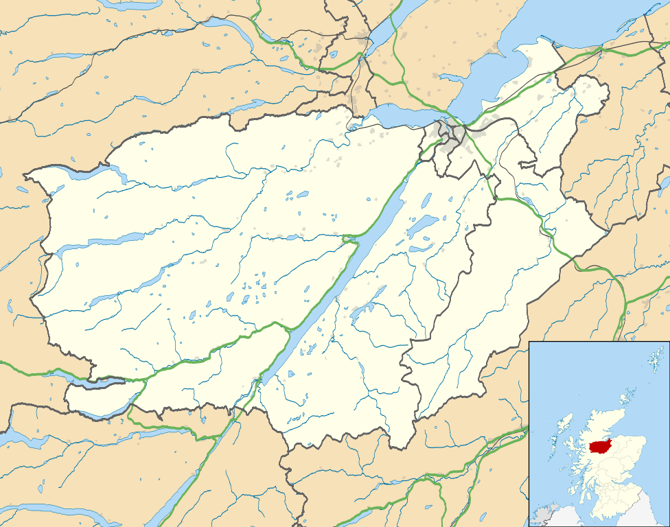
Map of the Inverness city management area, UK in 2011, with the following information shown:
Equirectangular map projection on WGS 84 datum, with N/S stretched 180% Geographic limits:
|
| تریخ | |
| سروت |
|
| لکھاری | Nilfanion, created using Ordnance Survey data |
| اجازت (فائل نوں دوبارہ ورتنا) |
ایس فائل نوں کریٹو کامنز Attribution 2.5 پولینڈ لائسنس دتا گیا. کس دے ناں: Contains Ordnance Survey data © Crown copyright and database right
|
| دوجے ورژن | File:Inverness UK blank map.svg - Blank map |
فائل دی تریخ
فائل نو اس ویلے دی حالت وچ ویکھن واسطے تاریخ/ویلے تے کلک کرو۔
| تریخ تے ویلہ | نکی مورت | پاسے | ورتن والا | تیپّݨی کرو | |
|---|---|---|---|---|---|
| موجودہ | ۰۶:۰۹, ۲۲ فروری ۲۰۱۱ | | ۱,۴۲۵ × ۱,۱۲۲ (۱.۵۹ میگابائٹ) | Nilfanion | {{Information |Description=Map of the Inverness city management area, UK in 2011, with the following information shown: *Ward boundaries *Coastline and lakes *Roads and railways *Urban areas Equirectangular map projection on WGS 84 datum, |
فائل دی ورتوں
تھلے دتے گئے 1 صفحے اس فائل نال جُڑدے نیں
فائل ویاپک ورتوں
ایہہ دوجے وکیاں ایس فائل نوں ورتدے نیں –
- ar.wikipedia.org تے ورتوں
- ceb.wikipedia.org تے ورتوں
- en.wikipedia.org تے ورتوں
- Fort Augustus
- Fort George, Highland
- Culloden, Highland
- Urquhart Castle
- Invermoriston
- Caledonian Stadium
- Drumnadrochit
- Merkinch
- Raigmore Hospital
- Cawdor
- Aberarder
- Abriachan
- Achnaconeran
- South Kessock
- Beauly
- Millburn, Inverness
- Smithton, Highland
- Westhill, Highland
- Balloch, Highland
- Tomatin
- Cannich
- Cabrich
- Scorguie
- Tornagrain
- Balnain
- Ardendrain
- Ardnagrask
- Croy, Highland
- Talk:Smithton, Highland
- Kiltarlity
- Dores, Highland
- Moy, Highland
- Achnabat
- Allanfearn
- Aigas
- Aldourie
- Bunloit
- Foyers, Highland
- Balbeg, Highland
- Bunchrew
- Barnyards, Highland
- Gorthleck
- Crask of Aigas
- Leachkin
- Inverfarigaig
- Camault Muir
- Corrimony
- Wester Aberchalder
ایس فائل دا ویکھو ہور جگت ورتن .