
فائل:Abraham Ortelius Map of Europe.jpg

ایس وکھالے دا ناپ: ۸۰۰ × ۵۸۴ پکسلز۔ دوجے ریزولوشنز: ۳۲۰ × ۲۳۴ پکسلز | ۶۴۰ × ۴۶۷ پکسلز | ۱,۰۲۴ × ۷۴۸ پکسلز | ۱,۲۸۰ × ۹۳۵ پکسلز | ۲,۶۹۱ × ۱,۹۶۵ پکسلز ۔
اصل فائل (۲,۶۹۱ × ۱,۹۶۵ پکسلز, فائل حجم: ۵.۹۲ میگابائٹ, MIME type: image/jpeg)
خلاصہ
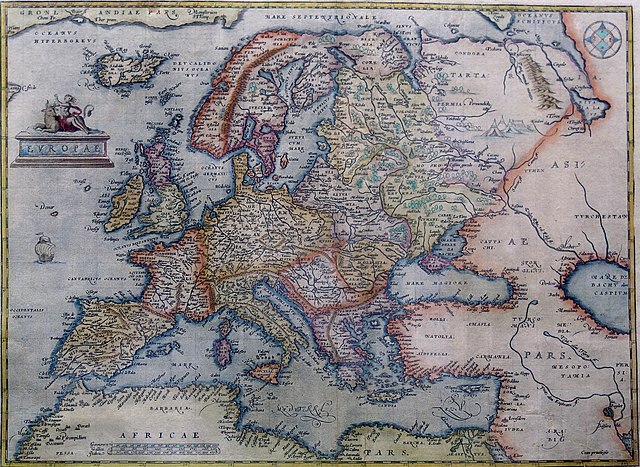
Hand-coloured copper engraving.
| تفصیل | Map of Europe | |||||||||||||||||||||||
| تریخ | ۱۵۷۰ - ۱۶۰۹ | |||||||||||||||||||||||
| سروت | Orteliusmaps.com | |||||||||||||||||||||||
| لکھاری |
|
|||||||||||||||||||||||
| دوجے ورژن |
Donaldheat.com Orteliusmaps.com a Orteliusmaps.com b Orteliusmaps.com c Orteliusmaps.com d Orteliusmaps.com e |
|||||||||||||||||||||||

لائسنس –
|
This is a faithful photographic reproduction of a two-dimensional, public domain work of art. The work of art itself is in the public domain for the following reason:
The official position taken by the Wikimedia Foundation is that "faithful reproductions of two-dimensional public domain works of art are public domain".
This photographic reproduction is therefore also considered to be in the public domain in the United States. In other jurisdictions, re-use of this content may be restricted; see Reuse of PD-Art photographs for details. | ||||
فائل دی تریخ
فائل نو اس ویلے دی حالت وچ ویکھن واسطے تاریخ/ویلے تے کلک کرو۔
| تریخ تے ویلہ | نکی مورت | پاسے | ورتن والا | تیپّݨی کرو | |
|---|---|---|---|---|---|
| موجودہ | ۰۵:۳۸, ۱۲ اگست ۲۰۲۱ | | ۲,۶۹۱ × ۱,۹۶۵ (۵.۹۲ میگابائٹ) | RafalZero7 | Cropped 2 % horizontally, 3 % vertically using CropTool with precise mode. |
| ۱۴:۱۷, ۱ اپریل ۲۰۱۱ |  | ۲,۷۴۹ × ۲,۰۱۷ (۵.۵۱ میگابائٹ) | Joop Rotte | {{Information |Description= |Source= |Date= |Author= |Permission= |other_versions= }}http://www.orteliusmaps.com/highresolution/6092_96.htm | |
| ۱۵:۳۴, ۲۴ جنوری ۲۰۰۶ |  | ۶۲۹ × ۴۶۸ (۲۸۷ کلوبائٹ) | AndreasPraefcke | Abraham Ortelius: Map of Europe, 1595 Hand-coloured copper engraving. {{Creator:Abraham Ortelius}} {{PD-art}} Source: http://www.donaldheald.com/ Category:Maps of Europe |
فائل دی ورتوں
تھلے دتے گئے 1 صفحے اس فائل نال جُڑدے نیں
فائل ویاپک ورتوں
ایہہ دوجے وکیاں ایس فائل نوں ورتدے نیں –
- ar.wikipedia.org تے ورتوں
- azb.wikipedia.org تے ورتوں
- az.wikipedia.org تے ورتوں
- ba.wikipedia.org تے ورتوں
- be-tarask.wikipedia.org تے ورتوں
- be.wikipedia.org تے ورتوں
- bn.wikipedia.org تے ورتوں
- bo.wikipedia.org تے ورتوں
- bs.wikipedia.org تے ورتوں
- ceb.wikipedia.org تے ورتوں
- cs.wikipedia.org تے ورتوں
- da.wikipedia.org تے ورتوں
- el.wikipedia.org تے ورتوں
- en.wikipedia.org تے ورتوں
- es.wikipedia.org تے ورتوں
- fa.wikipedia.org تے ورتوں
- fr.wikipedia.org تے ورتوں
- fy.wikipedia.org تے ورتوں
- ga.wikipedia.org تے ورتوں
- ha.wikipedia.org تے ورتوں
- hr.wikipedia.org تے ورتوں
- hy.wikipedia.org تے ورتوں
- id.wikipedia.org تے ورتوں
- it.wikipedia.org تے ورتوں
- ko.wikipedia.org تے ورتوں
- la.wikipedia.org تے ورتوں
- lv.wikipedia.org تے ورتوں
- mk.wikipedia.org تے ورتوں
ایس فائل دا ویکھو ہور جگت ورتن .