
فائل:Canada Quebec location map 2.svg

Size of this PNG preview of this SVG file: ۴۹۲ × ۵۹۹ پکسلز. دوجے ریزولوشنز: ۱۹۷ × ۲۴۰ پکسلز | ۳۹۴ × ۴۸۰ پکسلز | ۶۳۰ × ۷۶۸ پکسلز | ۸۴۰ × ۱,۰۲۴ پکسلز | ۱,۶۸۱ × ۲,۰۴۸ پکسلز | ۲,۳۱۶ × ۲,۸۲۲ پکسلز ۔
اصل فائل (ایس وی جی فائل، پکسل:۲,۳۱۶ × ۲,۸۲۲، فائل سائز: ۲.۵۶ میگابائٹ)
| تفصیل |
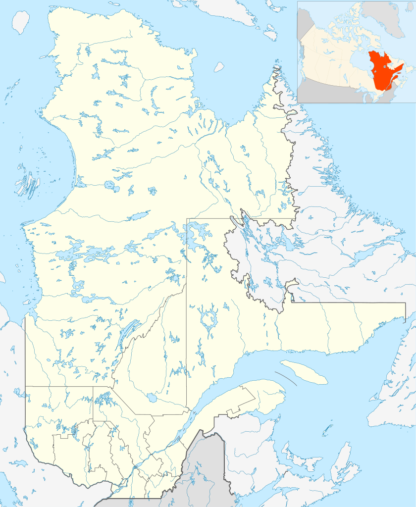
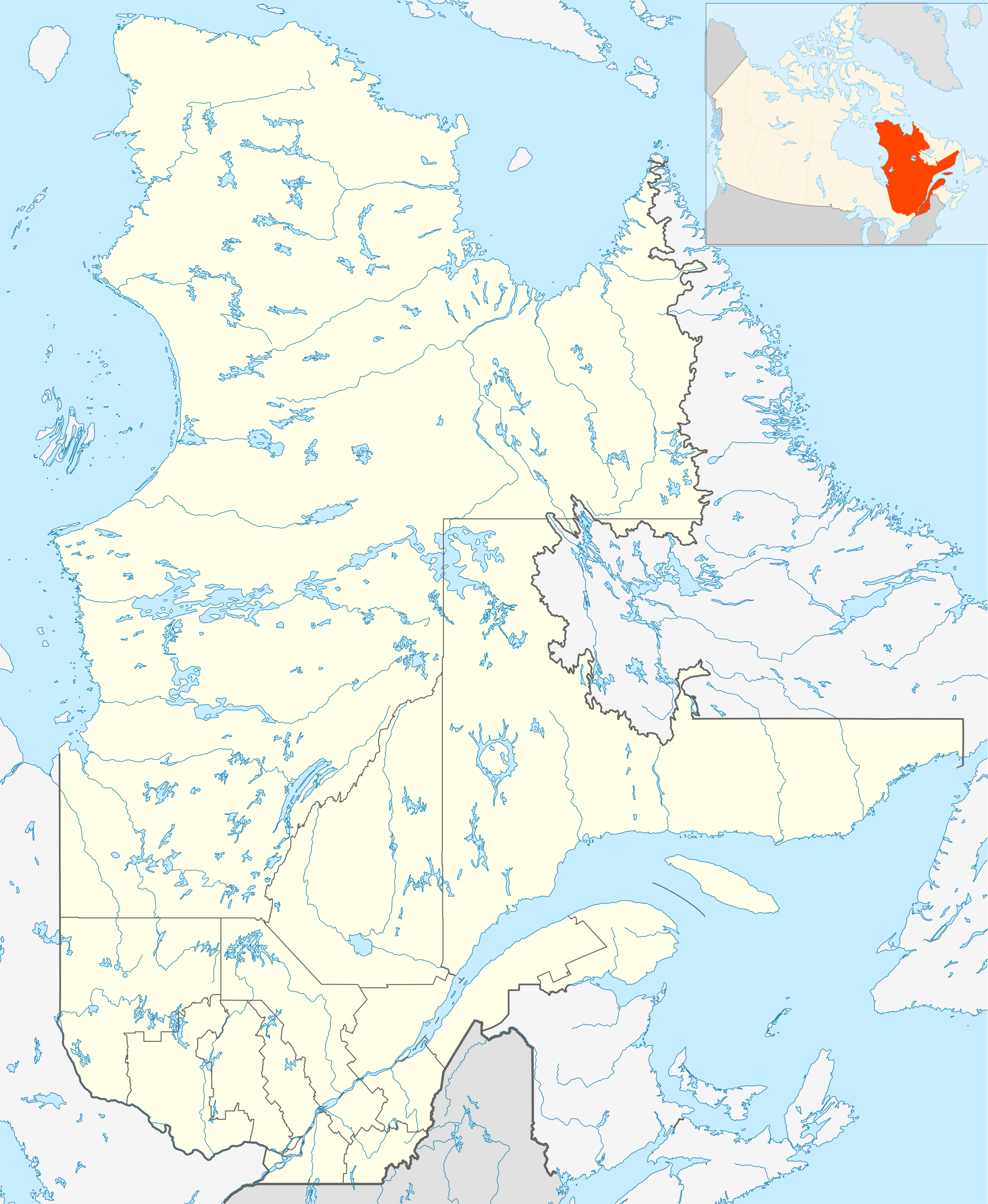
English: Québec Province within Canada.
Español: Provincia de Quebec en Canadá. |
| تریخ | |
| سروت | Based on Image:Canada_Quebec_location_map.svg |
| لکھاری | Hanhil (talk) 18:30, 24 September 2009 (UTC) based on EOZyo |
| میں، اس کم دے کاپیرائٹ دا مالک، اس کم نوں لوکاں واسطے دیندا واں۔ اے سارے جگ واسطے لاگو اے۔ کج ملکاں چ قانونی طور تے اے ممکن نئیں اے؛ اگر انج ای اے ے: میں ہر کسے نوں اس کم نوں کسے وی مقصد واسطے ورتن دا بغیر کسے شرط دے حق دیندا واں، اگر اوہ قانون دے خلاف نا ہوۓ۔ |
فائل دی تریخ
فائل نو اس ویلے دی حالت وچ ویکھن واسطے تاریخ/ویلے تے کلک کرو۔
| تریخ تے ویلہ | نکی مورت | پاسے | ورتن والا | تیپّݨی کرو | |
|---|---|---|---|---|---|
| موجودہ | ۲۳:۳۰, ۲۴ ستمبر ۲۰۰۹ | | ۲,۳۱۶ × ۲,۸۲۲ (۲.۵۶ میگابائٹ) | Hanhil | {{Information |Description={{en|1=Québec Province within Canada.}} {{es|1=Provincia de Quebec en Canadá.}} |Source=Based on Image:Canada_Quebec_location_map.svg |Author=~~~~ based on EOZyo |Date=2009-09-24 |Permission= |other_version |
فائل دی ورتوں
تھلے دتے گئے 5 صفحے اس فائل نال جُڑدے نیں
فائل ویاپک ورتوں
ایہہ دوجے وکیاں ایس فائل نوں ورتدے نیں –
- af.wikipedia.org تے ورتوں
- Montebello
- Baie-Comeau
- Charlesbourg
- Gatineau
- Laval, Quebec
- Trois-Rivières
- Saint-Hyacinthe
- Gaspé
- Thetford Mines
- Hull, Quebec
- Oka
- Sorel
- Tadoussac
- Saguenay
- Sainte-Anne-de-Beaupré
- Sherbrooke
- Longueuil
- Valcourt, Quebec
- Rouyn-Noranda
- Montreal-Wes
- Alma
- Sayabec
- Amqui
- Val-Brillant
- Rimouski
- Morin-Heights
- Granby, Quebec
- Sainte-Catherine, Quebec
- Westmount, Quebec
- ar.wikipedia.org تے ورتوں
- ast.wikipedia.org تے ورتوں
- azb.wikipedia.org تے ورتوں
- ban.wikipedia.org تے ورتوں
- be-tarask.wikipedia.org تے ورتوں
- bg.wikipedia.org تے ورتوں
- bn.wikipedia.org تے ورتوں
- ca.wikipedia.org تے ورتوں
- ceb.wikipedia.org تے ورتوں
- da.wikipedia.org تے ورتوں
- en.wikipedia.org تے ورتوں
ایس فائل دا ویکھو ہور جگت ورتن .