
فائل:PikiWiki Israel 16194 kiryat gat.jpg

ایس وکھالے دا ناپ: ۷۹۹ × ۵۹۹ پکسلز۔ دوجے ریزولوشنز: ۳۲۰ × ۲۴۰ پکسلز | ۶۴۰ × ۴۸۰ پکسلز | ۱,۰۲۴ × ۷۶۸ پکسلز | ۱,۲۸۰ × ۹۶۰ پکسلز | ۱,۶۸۲ × ۱,۲۶۲ پکسلز ۔
اصل فائل (۱,۶۸۲ × ۱,۲۶۲ پکسلز, فائل حجم: ۲.۸۳ میگابائٹ, MIME type: image/jpeg)
| تفصیل |
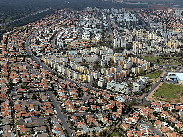
English: kiryat gat, Geography of Israel עברית: תצלום אווירי על הצד המערבי של העיר קרית גת, Original Image Name:תצלום אווירי, Location:קרית גת |
| تریخ | circa ۲۰۱۰ |
| سروت | Lehava Center Qiryat Gat via the PikiWiki - Israel free image collection project |
| لکھاری | ארכיון קרית גת |
| اجازت (فائل نوں دوبارہ ورتنا) |
اے فائل ایس لائسنس تھلے آندی اے Creative Commons Attribution 1.0 Generic . کس دے ناں: ארכיון קרית גת
|

|
This file has been submitted through the Israeli Pikiwiki project and uploaded here automatically.
The project is cooperation between the Israel Internet Association and Wikimedia Israel in an effort to promote the concept of free content on the Web, by creating an image collection of digital-format, good quality photographs, documenting events relating to the history of Israel, or depicting places of distinction in Israel and the Middle East. The Pikiwiki Project is managed from 2021 by the "Heritage Stones" group.
Please consider notifying the project before renaming or deleting this file. Further information about the project can be found on the commons-l mailing list.
|
فائل دی تریخ
فائل نو اس ویلے دی حالت وچ ویکھن واسطے تاریخ/ویلے تے کلک کرو۔
| تریخ تے ویلہ | نکی مورت | پاسے | ورتن والا | تیپّݨی کرو | |
|---|---|---|---|---|---|
| موجودہ | ۱۸:۱۳, ۱ جنوری ۲۰۱۲ | | ۱,۶۸۲ × ۱,۲۶۲ (۲.۸۳ میگابائٹ) | Pikiwikisrael | {{Information |Description={{en|kiryat gat, Geography of Israel}} {{he|תצלום אווירי על הצד המערבי של העיר קרית גת, Original Image Name:תצלום אווירי, Location:קרית גת}} |Source=Lehava Center Qiryat Gat vi |
فائل دی ورتوں
تھلے دتے گئے 1 صفحے اس فائل نال جُڑدے نیں
فائل ویاپک ورتوں
ایہہ دوجے وکیاں ایس فائل نوں ورتدے نیں –
- ar.wikipedia.org تے ورتوں
- arz.wikipedia.org تے ورتوں
- ca.wikipedia.org تے ورتوں
- ceb.wikipedia.org تے ورتوں
- el.wikipedia.org تے ورتوں
- en.wikipedia.org تے ورتوں
- es.wikipedia.org تے ورتوں
- fa.wikipedia.org تے ورتوں
- fi.wikipedia.org تے ورتوں
- he.wikipedia.org تے ورتوں
- hi.wikipedia.org تے ورتوں
- hy.wikipedia.org تے ورتوں
- id.wikipedia.org تے ورتوں
- ie.wikipedia.org تے ورتوں
- it.wikipedia.org تے ورتوں
- ja.wikipedia.org تے ورتوں
- ka.wikipedia.org تے ورتوں
- ko.wikipedia.org تے ورتوں
- mn.wikipedia.org تے ورتوں
- nl.wikipedia.org تے ورتوں
- nn.wikipedia.org تے ورتوں
- no.wikipedia.org تے ورتوں
- ru.wikipedia.org تے ورتوں
- simple.wikipedia.org تے ورتوں
- sr.wikipedia.org تے ورتوں
- ta.wikipedia.org تے ورتوں
- tr.wikipedia.org تے ورتوں
- uk.wikipedia.org تے ورتوں
- ur.wikipedia.org تے ورتوں
- www.wikidata.org تے ورتوں
- yi.wikipedia.org تے ورتوں
- zh.wikipedia.org تے ورتوں