
فائل:Map of the United Provinces from The Imperial Gazetteer of India (1907-1909).jpg
ایس وکھالے دا ناپ: ۵۰۵ × ۵۹۹ پکسلز۔ دوجے ریزولوشنز: ۲۰۲ × ۲۴۰ پکسلز | ۴۰۵ × ۴۸۰ پکسلز | ۱,۰۰۰ × ۱,۱۸۶ پکسلز ۔
اصل فائل (۱,۰۰۰ × ۱,۱۸۶ پکسلز, فائل حجم: ۴۲۷ کلوبائٹ, MIME type: image/jpeg)
.jpg)
jai jaat
خلاصہ
| تفصیل |
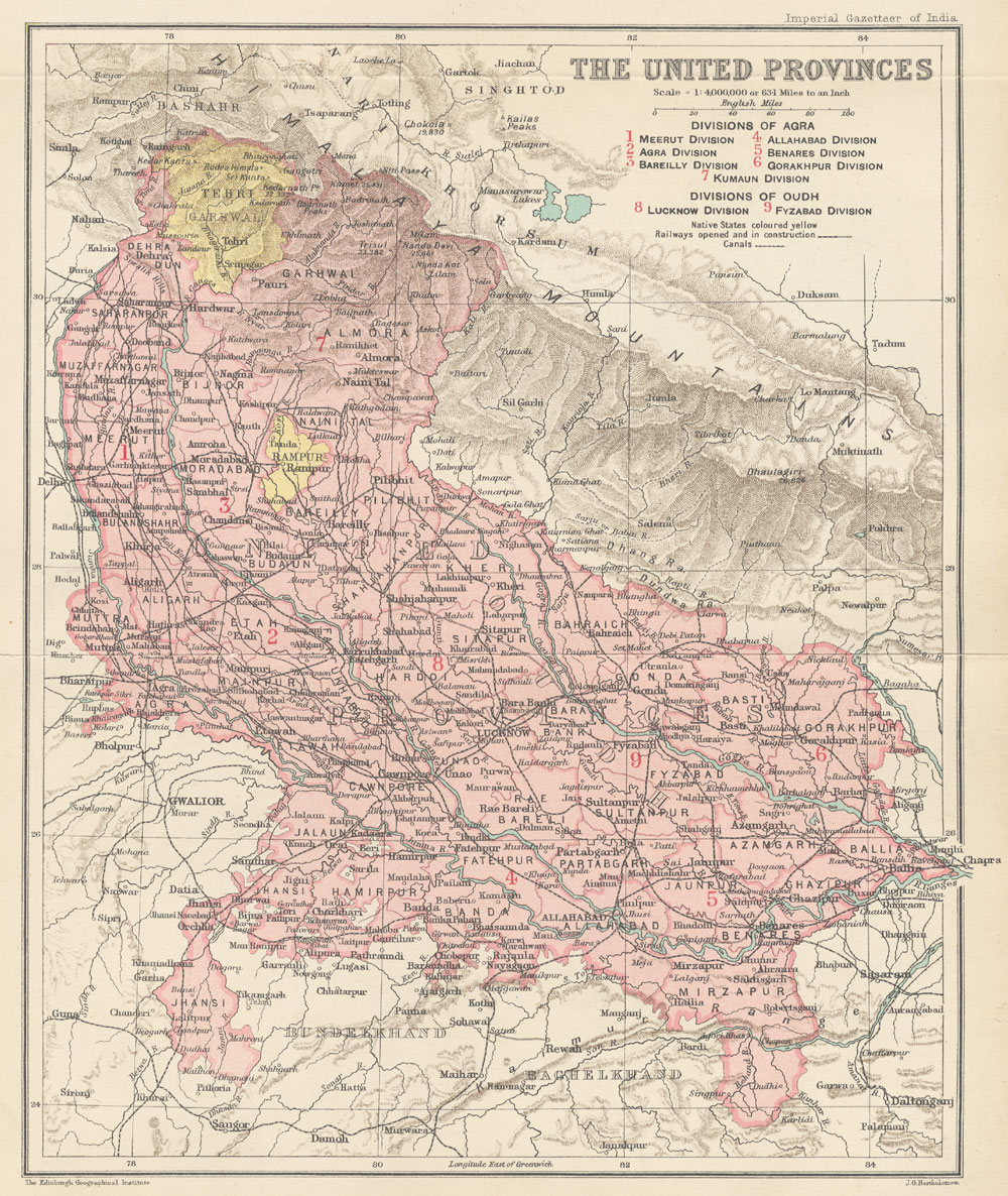
English: Map of United Provinces from The Imperial Gazetteer of India Volume 24, opposite page 250. New edition, published under the authority of His Majesty's Secretary of State for India in Council. Oxford: Clarendon Press, 1907-1909.
Scale: 1:6,000,000. 1 in. to 94.6 miles. Divisions of Agra: 1. Meerut Division, 2. Agra Division, 3. Bareilly Division, 4. Allahabad Division, 5. Benares Division, 6. Gorakhpur Division, 7. Kumaun Division. Divisions of Oudh: 8. Lucknow Division, 9. Fyzabad Division. |
| تریخ | ۱۹۰۷ - ۱۹۰۹ |
| سروت | http://dsal.uchicago.edu/maps/gazetteer/index.html |
| لکھاری | John G. Bartholomew |
لائسنس –
The author died in 1920, so this work is in the public domain in its country of origin and other countries and areas where the copyright term is the author's life plus 100 years or fewer. | |
| ایہ فائل دے بارے چ دس اے جے اے کاپی حف دیاں روکاں توں کھلی اے تے نالدے رلدے حقاں توں وی۔ | |
فائل دی تریخ
فائل نو اس ویلے دی حالت وچ ویکھن واسطے تاریخ/ویلے تے کلک کرو۔
| تریخ تے ویلہ | نکی مورت | پاسے | ورتن والا | تیپّݨی کرو | |
|---|---|---|---|---|---|
| موجودہ | ۱۱:۱۹, ۸ اکتوبر ۲۰۱۴ | | ۱,۰۰۰ × ۱,۱۸۶ (۴۲۷ کلوبائٹ) | Co9man | User created page with UploadWizard |
فائل دی ورتوں
تھلے دتے گئے 3 صفحے اس فائل نال جُڑدے نیں
فائل ویاپک ورتوں
ایہہ دوجے وکیاں ایس فائل نوں ورتدے نیں –
- bn.wikipedia.org تے ورتوں
- ca.wikipedia.org تے ورتوں
- de.wikipedia.org تے ورتوں
- en.wikipedia.org تے ورتوں
- fr.wikipedia.org تے ورتوں
- hi.wikipedia.org تے ورتوں
- id.wikipedia.org تے ورتوں
- it.wikipedia.org تے ورتوں
- mr.wikipedia.org تے ورتوں
- pl.wikipedia.org تے ورتوں
- ru.wikipedia.org تے ورتوں
- simple.wikipedia.org تے ورتوں
- ta.wikipedia.org تے ورتوں
- ur.wikipedia.org تے ورتوں
- www.wikidata.org تے ورتوں
.jpg)