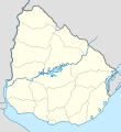
فائل:Uruguay location map.svg

Size of this PNG preview of this SVG file: ۵۵۰ × ۶۰۰ پکسلز. دوجے ریزولوشنز: ۲۲۰ × ۲۴۰ پکسلز | ۴۴۰ × ۴۸۰ پکسلز | ۷۰۵ × ۷۶۸ پکسلز | ۹۳۹ × ۱,۰۲۴ پکسلز | ۱,۸۷۹ × ۲,۰۴۸ پکسلز | ۱,۰۰۰ × ۱,۰۹۰ پکسلز ۔
اصل فائل (ایس وی جی فائل، پکسل:۱,۰۰۰ × ۱,۰۹۰، فائل سائز: ۶۲ کلوبائٹ)
فائل دی تریخ
فائل نو اس ویلے دی حالت وچ ویکھن واسطے تاریخ/ویلے تے کلک کرو۔
| تریخ تے ویلہ | نکی مورت | پاسے | ورتن والا | تیپّݨی کرو | |
|---|---|---|---|---|---|
| موجودہ | ۱۰:۴۳, ۱۶ مارچ ۲۰۲۴ |  | ۱,۰۰۰ × ۱,۰۹۰ (۶۲ کلوبائٹ) | GrandEscogriffe | more correct north-south stretching |
| ۰۶:۴۳, ۱۳ جولائی ۲۰۱۶ |  | ۱,۰۰۰ × ۱,۰۵۶ (۷۴ کلوبائٹ) | Janitoalevic | Added Rincón de Artigas and isla Brasilera disputes and fixed brazilian border in the north of the map. | |
| ۱۹:۱۹, ۱۰ فروری ۲۰۱۱ |  | ۱,۰۰۰ × ۱,۰۵۶ (۷۷ کلوبائٹ) | Antonsusi | ... | |
| ۱۹:۱۲, ۱۰ فروری ۲۰۱۱ |  | ۱,۰۰۰ × ۱,۰۵۶ (۷۷ کلوبائٹ) | Antonsusi | try again | |
| ۱۹:۱۰, ۱۰ فروری ۲۰۱۱ |  | ۳,۰۰۰ × ۳,۱۶۸ (۷۷ کلوبائٹ) | Antonsusi | repair | |
| ۱۲:۰۴, ۷ مارچ ۲۰۱۰ |  | ۱,۰۰۰ × ۱,۰۵۶ (۱۱۴ کلوبائٹ) | Spischot | Default size inceased | |
| ۰۳:۲۶, ۲۶ اکتوبر ۲۰۰۹ |  | ۳۴۴ × ۳۶۳ (۱۳۹ کلوبائٹ) | Spischot | {{Information |Description={{de|Positionskarte von Uruguay}} Quadratische Plattkarte, Geographische Begrenzung der Karte: * N: 29.86° S * S: 35.19° S * W: 58,71° W * O: 52,89° W {{en|Location map of Uruguay}} Equ |
فائل دی ورتوں
تھلے دتے گئے 1 صفحے اس فائل نال جُڑدے نیں
فائل ویاپک ورتوں
ایہہ دوجے وکیاں ایس فائل نوں ورتدے نیں –
- af.wikipedia.org تے ورتوں
- als.wikipedia.org تے ورتوں
- an.wikipedia.org تے ورتوں
- ar.wikipedia.org تے ورتوں
- ast.wikipedia.org تے ورتوں
- Colonia del Sacramento
- Regueru Mataojito
- Montevidéu
- Minas
- Universidá de la República
- Módulu:Mapa de llocalización/datos/Uruguái
- Módulu:Mapa de llocalización/datos/Uruguái/usu
- Palaciu Llexislativu del Uruguái
- Florida (Uruguái)
- Aguas Corrientes
- Canelones (Uruguái)
- Durazno (Uruguái)
- Trinidad (Uruguái)
- San José de Mayo
- Mercedes (Uruguái)
- Maldonado (Uruguái)
- Rocha (Uruguái)
- Treinta y Tres
- Melo
- Fray Bentos
- Tacuarembó
- Rivera (Uruguái)
- Artigas (Uruguái)
- Paysandú (Uruguái)
- Salto (Uruguái)
- Toledo (Uruguái)
- Progreso (Uruguái)
- Las Piedras (Uruguái)
- La Paz (Canelones)
- Santa Lucía (Uruguái)
- Atlántida (Uruguái)
- Barros Blancos
- Ciudad de la Costa
- Colonia Nicolich
- Empalme Olmos
- La Floresta (Uruguái)
- Los Cerrillos (Canelones)
- Migues
- Montes (Uruguái)
ایس فائل دا ویکھو ہور جگت ورتن .

